|
Trip Date: 6.30.2001
Map
Reference (email me for the trail
map):
Colorado
Atlas and Gazetteer (DeLorme), p.39
The Roads of Colorado p.71
Trails
Illustrated #103
STARTING
POINT: County 3 and County 2, 1.1 miles northwest of Central City (GPS:
N39.4849, W105.3177)
TRAIL:
County 3 -> 4 Rd -> 4N Rd -> Rollins Pass Road
FINISHING POINT: Colorado 119 in Rollinsville, approximately 13 miles
north of Black Hawk (GPS:
N39.5502, W105.3011)
TOTAL MILEAGE: 16.2 miles
UNPAVED MILEAGE: 15.4 miles
DRIVING TIME: 1 hour
ROUTE ELEVATION: 8600 feet to 10600 feet
USUALLY OPEN: June to October
DIFFICULTY RATING: 3
SCENIC RATING: 8
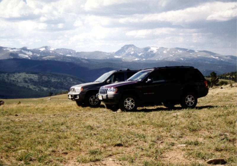
On the top of Rollins Pass. The photo is like a
car ad. Here is a good views to the southwest to Kingstone Peak and surrounding
areas.
The Rollins Pass Trail passes the sites fo many old mining town. Apex,
founded in 1891 and platted in 1895, was established to provide housing
for miners working the several good mines within a mile of town.

Uphill to Rollins Pass. The road is bumpy but still
easy.
The most difficult section of road is the stretch between Tolland and
Nugget. It can be rough and rutted, especially late in the season. After
Apex, the road to Central City is a maintained county road through pleasant
land.

|


